Glacier area and glacier lake outlines for mainland Norway 2018-2019
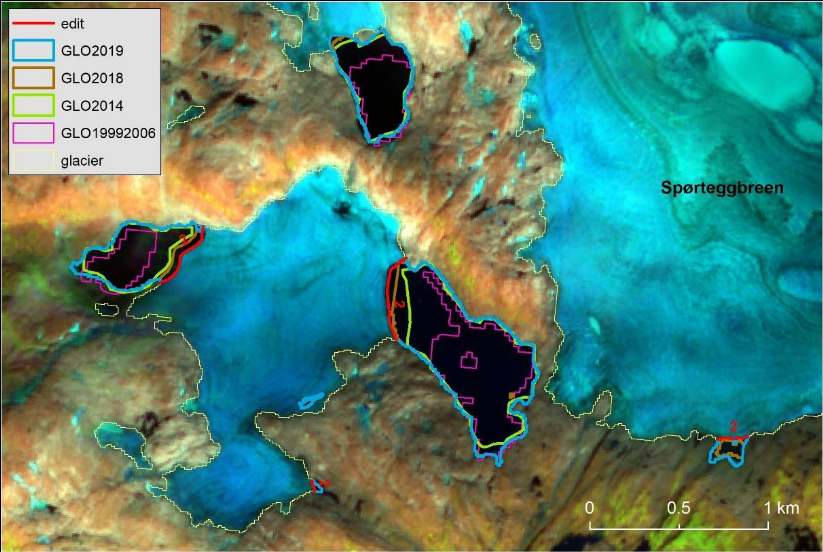
NVE has used Sentinel-2 imagery from 2018 and 2019 to derive updated glacier area outlines (GAO) and glacier lake outlines (GLO) for mainland Norway. The glacier area outlines were derived using the semi-automated band-ratio method with manual corrections. Glacier lake outlines for 2018 were conducted by calculating the Normalized Differential Water Index (NDWI) and manually correcting outlines when necessary. An updated glacier lake product for 2018-2019, GLO2018-2019, was produced to match the new 2018-2019 glacier outlines for mainland Norway using manual digitisation.
The data are described in two NVE reports and one scientific paper:
Andreassen LM (ed.), G. Moholdt, A. Kääb, A. Messerli, T. Nagy and S.H. Winsvold (2021) Monitoring glaciers in mainland Norway and Svalbard using Sentinel. NVE Rapport 3-2021, 94 s. https://publikasjoner.nve.no/rapport/2021/rapport2021_03.pdf
Andreassen, L.M. (2022) Breer og fonner i Norge. NVE Rapport 3-2022, 48 s. https://publikasjoner.nve.no/rapport/2022/rapport2022_03.pdf
Andreassen, L.M., T. Nagy, B. Kjøllmoen, J.R. Leigh (2022) An inventory of Norway’s glaciers and ice-marginal lakes from 2018–19 Sentinel-2 data. Journal of Glaciology, 1–22. https://doi.org/10.1017/jog.2022.20